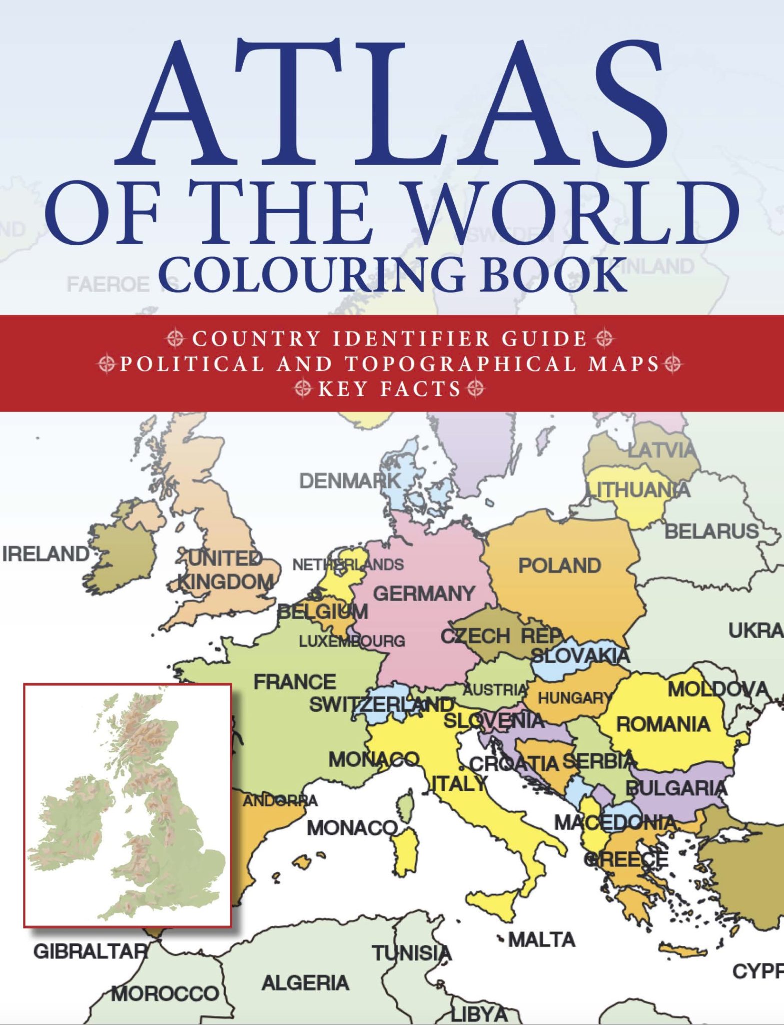


Atlas of the World Colouring Book
Can you name all the countries in Central America from north to south? Did you know that Reno in Nevada is further west than Los Angeles in California? Do you know which countries the River Nile flows through from source... Read moreRead less
Can you name all the countries in Central America from north to south? Did you know that Reno in Nevada is further west than Los Angeles in California? Do you know which countries the River Nile flows through from source to emptying in the Mediterranean?
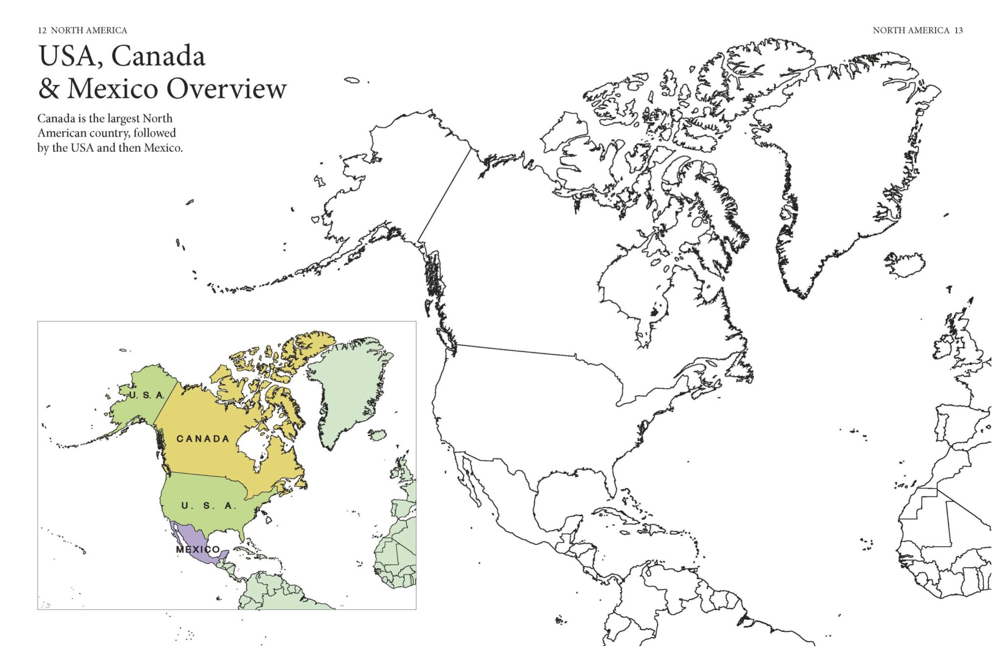
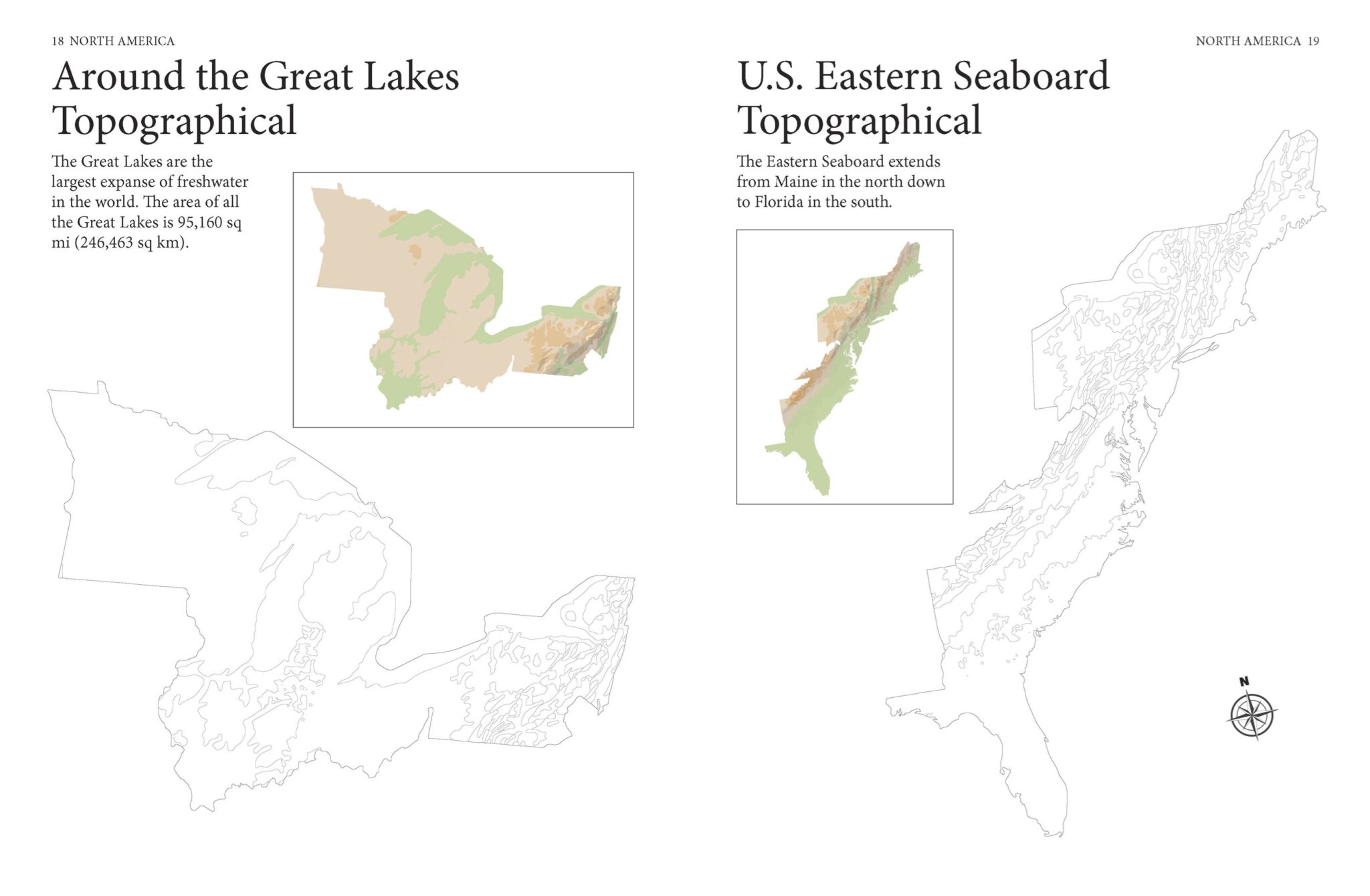
Atlas of the World Coloring Book is a fun way to explore the world. The book features 170 maps, with both the completed colour original and an accompanying line drawing for you to colour in. From Alaska to Zanzibar, the book ranges all around the world, covering – often in separate maps – both political boundaries and topographical features. Including maps that cover the whole of the continental United States as well as ones that focus more narrowly on the eastern seaboard or the Great Lakes, the book features an immense range of maps.
From political maps of Africa to the ridge that the Alps form across Europe to tracing the course of the Amazon, the book is an excellent way to refresh your geographical knowledge and learn some fascinating new facts, with each map accompanied by a caption offering a nugget of information. If you’ve never been sure where Addis Ababa is, or where the Danube reaches the sea, or even what the state capital of Wyoming is (it’s Cheyenne), here’s your solution.
With 170 outstanding colour artworks, Atlas of the World Coloring Book is both an excellent reference guide and a relaxing learning tool.
Format: 297 x 227mm
Extent: 224pp
Word count: 7000
Illustrations: 170 colour artworks; 170 line drawings
There is no Amber trade edition currently available.
Buy now:

![Astrology [Chinese Bound]](https://www.amberbooks.co.uk/wp-content/uploads/2018/08/9781782746775.MAIN_thumb-e1750345174832.jpg)
![The Art of War: A New Translation [Chinese Bound series]](https://www.amberbooks.co.uk/wp-content/uploads/2018/08/9781838866327_thumb-e1750264127486.jpg)
![Haiku [Chinese Bound]](https://www.amberbooks.co.uk/wp-content/uploads/2024/08/MG_1364_thumb-e1750346907116.jpg)

![Bushido: The Soul of Japan [Chinese Bound]](https://www.amberbooks.co.uk/wp-content/uploads/2024/08/9781838866884-final_thumb.jpg)
![Saints Illustrated [Chinese Bound]](https://www.amberbooks.co.uk/wp-content/uploads/2023/10/MG_0299_thumb-e1750347743381.jpg)